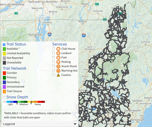
With the recent heavy snowfall in parts of New Hampshire there has been renewed interest in the NHSA web map and the corresponding iPhone and Droid map apps.
Recently there have been many updates to the trail map in cooperation with the clubs and in partnership with the NH Bureau of Trails.
The map indicates regional Trail Status defined as: Available, Limited Availability and Unavailable.

Since the snowfall, map users have been looking for updated Trail Status.
Under the current conditions it is simply too early to provide this level of reliable information.
Conditions varying widely due to the lack of frozen ground, wet areas and gates that are not yet open.
While one area of the state may have abundant snow and open trails, a neighboring club may not. This can be the case throughout the winter.
At this moment club websites, social media, and direct communication would be the best source of information about the conditions in a specific area. The NH Bureau of Trails also posts conditions.
We know that clubs are working to open what they can – where they can. We do encourage clubs to let the NH Trails Bureau and NHSA know the overall conditions in their trail systems to help facilitate being able to leverage this information exchange on the map.
Thank you, Terry Callum, NHSA Trails Chair.

You must be logged in to post a comment.